N.C. Native History: from the archives to the stage

Rhiannon Giddens has spent the last several years in residency with Carolina Performing
Arts, building connections and community across campus in addition to conducting primary source research in Wilson Library. During her Spring 2023 residency, Rhiannon visited a meeting of the Land Back / Abolition Project and heard from students and faculty conducting archival research into the place-based history of campus as it relates to stolen Native land and enslaved labor. Rhiannon encountered historic campus maps presented by this group and was struck by the way in which they so plainly communicated the history of land theft upon which our country was founded and expanded.
Rhiannon knew that she wanted to bring archival materials to the stage during her Southern Futures Research Residency culminating performance and expressed a desire for materials related to land and the on-going fight for Native sovereignty in North Carolina. When CPA staff and Rhiannon began to explore the idea of using archival materials as a backdrop for the performance, they returned to the idea of maps, turning to the North Carolina Maps online database to discover historic maps of the state that documented settler knowedlge of Native land and communities.
More modern archival images of Native communities and traditions were also featured during the performance, in addition to historic North Carolina maps. These images, created between the 1980s through the 2000s, depict Native peoples, culture, and life from across the state, including Powwows, heritage events, quilting traditions, and other topics. The materials come from various collections maintained by the Louis Round Wilson Library.
The historic map images were paired with the modern images of Native people to create layered projections that served as a backdrop for Rhiannon and her collaborators as they performed. The maps encourage us to think about the history of white colonial settlers stealing land from Native people, land that tribes are still fighting for today. The modern images of Native communities have been placed over the maps to represent the ways in which Native communities have continued to thrive in the face of oppression and erasure.
Historic North Carolina Maps
A collection of maps was curated collaboratively between Rhiannon and CPA staff to be used as a backdrop for the Roots & Reclamation performance. All of the maps can be found on North Carolina Maps, a collaborative digitization project by the State Archives of North Carolina, the Outer Banks History Center, and the University Library at UNC-Chapel Hill. Rhiannon wanted to include maps that represented colonial settler knowedlge of Native land as such maps stand as proof that white colonists consciously stole land from Native people across the state and nation. The maps were created as early as the 1500s and as late as the 1930s, and depict a wide range of Native tribes.
-

This map was created in 1775 by John Lodge and James Adair. It depicts Native Nations across the Southern United States. Depicts the American colonies from Lake Erie south to Florida and from the Mississippi River to the Atlantic coast. Names of Native American tribes are denoted throughout the map. North Carolina tribes shown are the "Upper Cheerake" (Cherokee), Congarees, and "Katahba" (Catawb). "Granvill" is printed in the northeastern part of the colony, denoting Lord Granville's Line. This map is held in the North Carolina Collection of Wilson Library here at the University. -

This map depicts the colonies of Carolina, Maryland, and Virginia. It also covers Delaware, southern Pennsylvania, New Jersey, western Long Island, southwestern Connecticut, and portions of adjacent areas. Several Native American villages are represented, including, in Carolina, those of the Weapemeok and Secotan. This map can be found in the North Carolina Maps Collection in Wilson Library. -

This map is a redrawn copy, probably by John R. Swanton, of a ca. 1715 manuscript map in the British Public Record Office in London (C.O. 700, Carolina no. 3). The map portrays the southern part of Virginia, North and South Carolina, and Florida. The locations of the various Indian tribes in the Southeast are noted, and statistics regarding the number of men and villages are reported. European towns, forts, and other settlements are identified, and major trading paths are shown. Tribes depicted include the Cherokee, Choctaw, Yamasee, Apalachee, Waxhaw, and Catawba. This map can be found in the North Carolina Maps Collection in Wilson Library. -
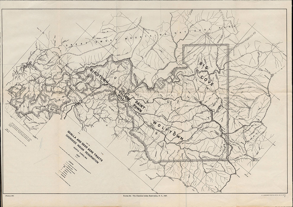
This map was created by the U.S. Office of Indian Affairs in 1941 and depicts the Qualla Cherokee Reservation in 1937. The map shows mountains, creeks, roads, houses, churches, schools, cemeteries, "Indian Service telephone lines" and fire lookout towers. It is oriented with north to the upper right. This map can be found in the North Carolina Collection in Wilson Library. -
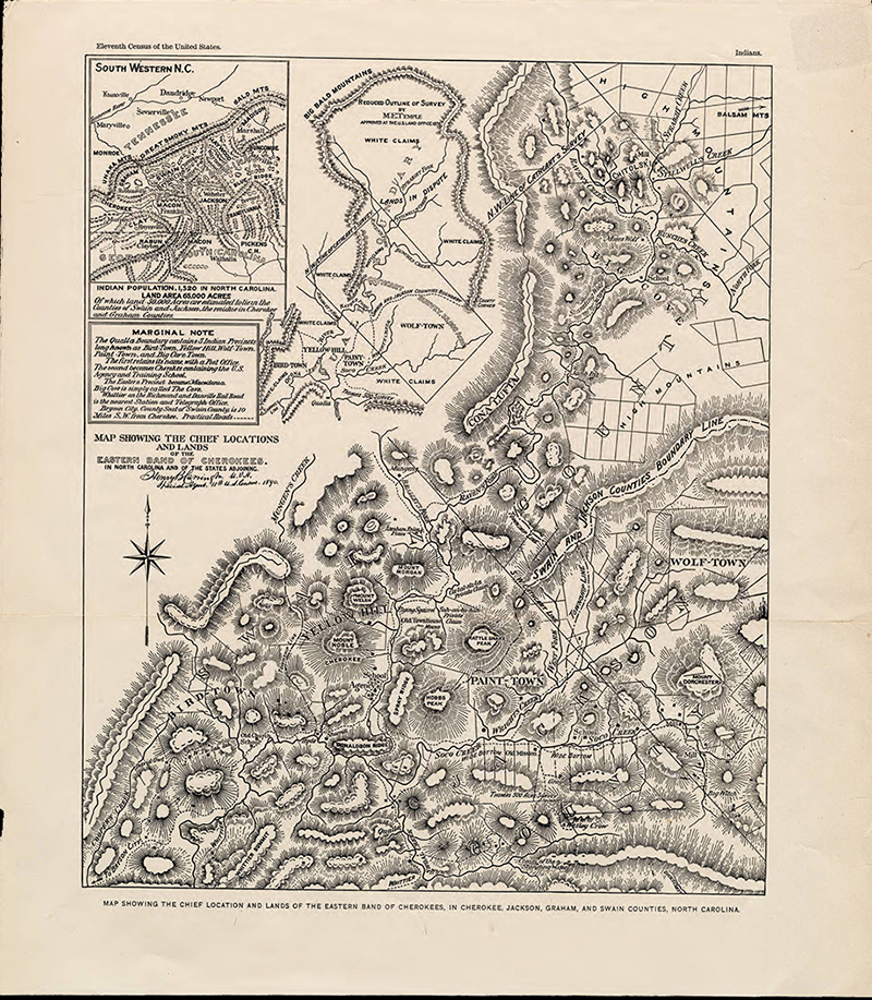
This map was published c.1890 by the U.S. Census Office. It shows five Cherokee "Indian Precincts": Bird-Town, Yellow Hill, Wolf-Town, Paint-Town, and Big Cave Town. The map also lists population and acreage. The inset map in the top left corner depicts: "South western N.C." This map also features creeks, mills, houses (some with ownership), mountains (with peak names), schools, and churches. This map can be found in the North Carolina Maps Collection in Wilson Library. -
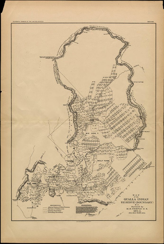
This map was published c.1890 by the U.S. Census Office. It covers Cherokee settlements of Bird Town, Yellow Hill, Paint Town, Wolf Town, and Big Cove. Shows mountain ridges and watersheds, county lines, township lines, numbered lots, and rivers. Includes note from Department of the Interior, General Land Office. This map can be found in the North Carolina Maps Collection in Wilson Library. -
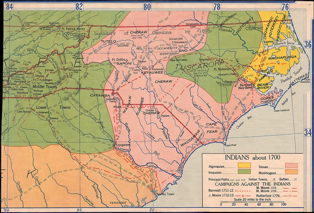
This is a contemporary map by an unknown cartographer/ publisher portraying the areas of settlement of Native American tribes in North Carolina, South Carolina, Georgia, eastern Tennessee, and southern Virginia at about the year 1700. Native towns and trading paths and the sites of battles between colonists and Native Americans are shown. The routes of expeditions against Native Americans led by Captain John Barnwell, Colonel James Moore, Maurice Moore, and Griffith Rutherford are also noted. Tribes depicted include the Cherokee, Tutelo, Cheraw, Saponi, Keyauwee, Catawba, Waccamaw, Sugaree, Tuscarora, Meherrin, Nottoway, Chowanoc, Pasquotank, Poteskeet, Machapunga, Bear River, Pamlico, and Coree. This map is currently held in the State Archives of North Carolina. -
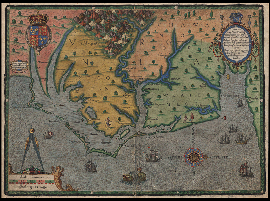
This is a hand-colored view of the coast of North Carolina at the time of the first attempt at a British settlement in North America, 1585. The map shows the Outer Banks and coast of North Carolina from the modern Virginia border south to Cape Fear. The Native American villages of Secotan and Weapemeoc are depicted, as well as many others. There are many hand-drawn illustrations, including ships, sea monsters, Native Americans, and mountains. North is oriented to the right. This map can be found in the North Carolina Maps Collection in Wilson Library. -

This map shows North Carolina west to the Blue Ridge mountains, and parts of Virginia and South Carolina. It depicts cities and towns, natural features, roads and paths, mills, chapels, landowners, soundings, swamps, pocosins, and forts. Native American tribes mentioned include the Meherrin, Catawba, and Tuscarora. This map is held in the North Carolina Map collections of Wilson Library. -
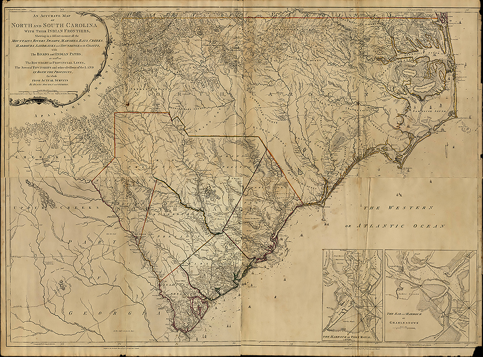
This map was created in 1775 from the information gathered by surveyor Henry Mouzon. Map shows North and South Carolina, and part of Georgia. Relief shown by hachures, depth shown by soundings. Depicts towns and villages, mills, roads, courthouses, Quaker meeting houses, and churches. Native American tribes shown include the Meherrin and Tuscarora in northeastern North Carolina, the Catawba south of Mecklenburg County, and the Cherokee in the far western part of the state. Insets show "The Harbour of Port Royal" and "The Bar and Harbour of Charlestown." It is currently held by the State Archives of North Carolina.
Materials from the scrapbooks of John Blackfeather Jeffries
John Hayles Blackfeather Jeffries (1939 – 2023) spent most his life in Hillsborough, N.C. He was a Tribal Council member of the Occaneechi Band of the Saponi Nation in North Carolina, and was a crafter of traditional regalia, weapons, and tools. Mr. Jeffries led the creation of the historic Occaneechi Indian Village in Hillsborough. Mr. Jeffries’s papers are held in Carolina’s Southern Historical Collection of Wilson Library. The collection contains photographic prints, photographic albums, printed items, clippings, articles and essays, transcriptions of interviews, a petition for acknowledgment of tribal status for the Occaneechi Band of the Saponi Nation in North Carolina, sound recordings, video recordings, and other items pertaining to the Occaneechi. Mr. Jeffries created several scrapbooks dedicated to various projects and subjects; the images below come from scrapbooks about the Occaneechi Band of the Saponi Nation, Occaneechi heritage and culture, and projects such as Mr. Jeffries’s craft practice and the building of the historic Occaneechi Village in Hillsborough.
-
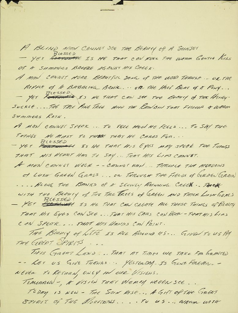
A prayer by John Hayles Blackfeather Jeffries, 2006 -
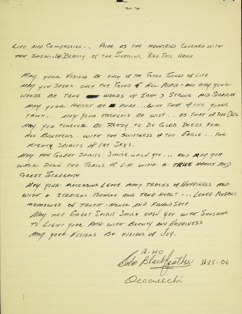
A prayer by John Hayles Blackfeather Jeffries, 2006 -

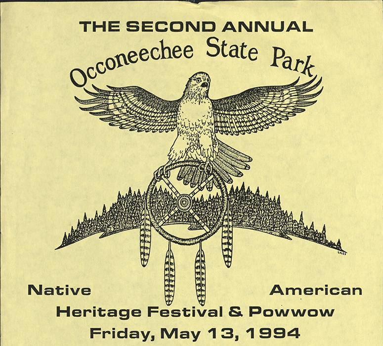
This photograph shows Ms. Lynette Jeffries at Occaneechi State Park in Clarksville, V.A. in December of 1996. This photograph was taken by John Blackfeather Jeffries, Ms. Lynette’s husband, and both individuals helped to organize annual Native American Heritage Festivals and Powwows at Occaneechi State Park. This photograph can be found in an album dedicated to various projects Mr. Jeffries carried out, including heritage festivals, museum exhibitions of his crafted items, and the building of historically accurate Native structures. -
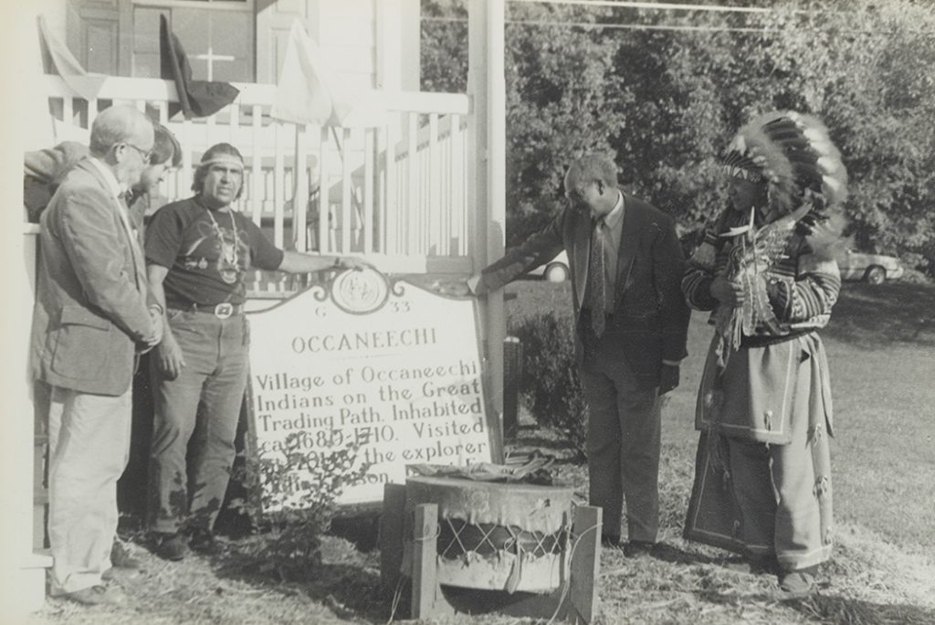
This image depicts the Occaneechi Historical Marker, John Blackfeather Jeffries, and others. Today, you can see this marker on Churton St. (US 70 Bussiness) at Eno River Bridge in Hillsborough. -
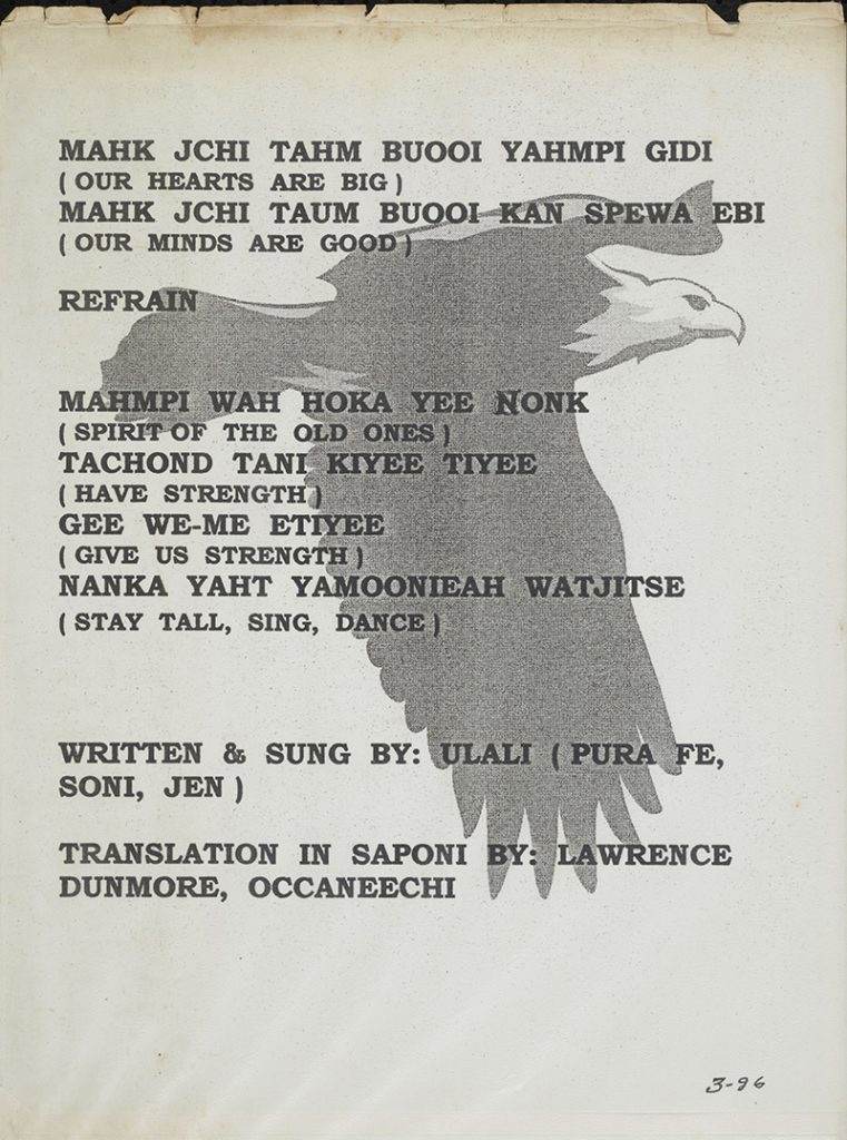
This prayer can be found in an album created by John Blackfeather Jeffries. It was written and sung by Pura Fé, one of tonight’s performers. -
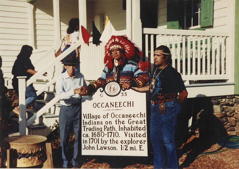
This image depicts the Occaneechi Historical Marker, John Blackfeather Jeffries, and others. Today, you can see this marker on Churton St. (US 70 Bussiness) at Eno River Bridge in Hillsborough.
Occaneechi Band of the Saponi NAtion Powwow Photographs
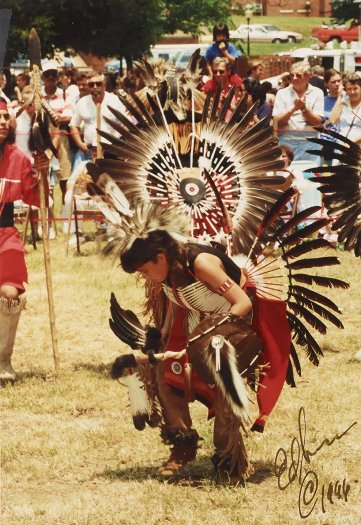
These images of locally held Occaneechi Saponi Powwows can be found in two photo albums created by John Blackfeather Jeffries. The albums are part of the John Halyes Blackfeather Jeffries Collection in Wilson Library’s Southern Historical Collection. They were taken by photographers Ed Sanseverino in 1996 and David Hunt in 2003. The 2003 Powwow took place at the Occaneechi Historic Village in Hillsborough. Ceremonial dances, regalia, and cultural customs are depicted in the albums, which include both photographs and newspaper clippings about the event. These albums have been digitized and you can explore both the 1996 album and the 2003 album through the University Libraries Digital Collection Repository.
-
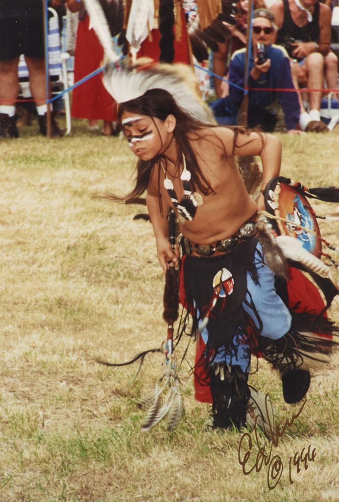
Occaneechi Saponi Powwow, Hillsborough, N.C., June 8, 1996. Photographed by Ed Sanseverino. -
Occaneechi Saponi Powwow, Hillsborough, N.C., June 8, 1996. Photographed by Ed Sanseverino. -

Occaneechi Saponi Powwow, Hillsborough, N.C., June 8, 1996. Photographed by Ed Sanseverino. -
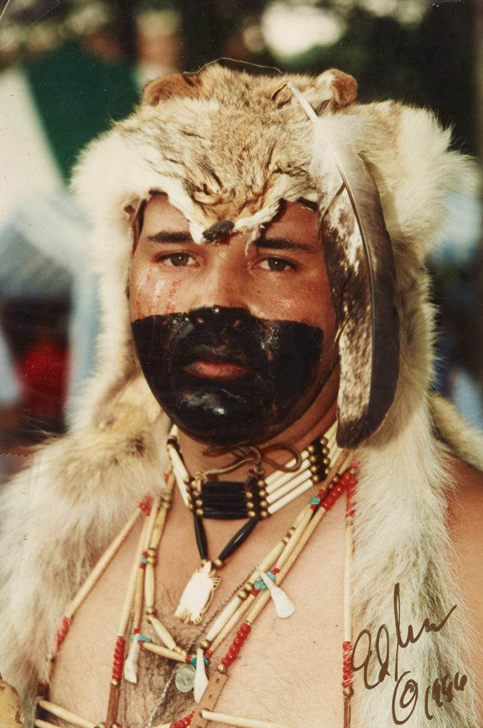
Occaneechi Saponi Powwow, Hillsborough, N.C., June 8, 1996. Photographed by Ed Sanseverino. -

Occaneechi Saponi Powwow, Hillsborough, N.C., June 8, 1996. Photographed by Ed Sanseverino. -
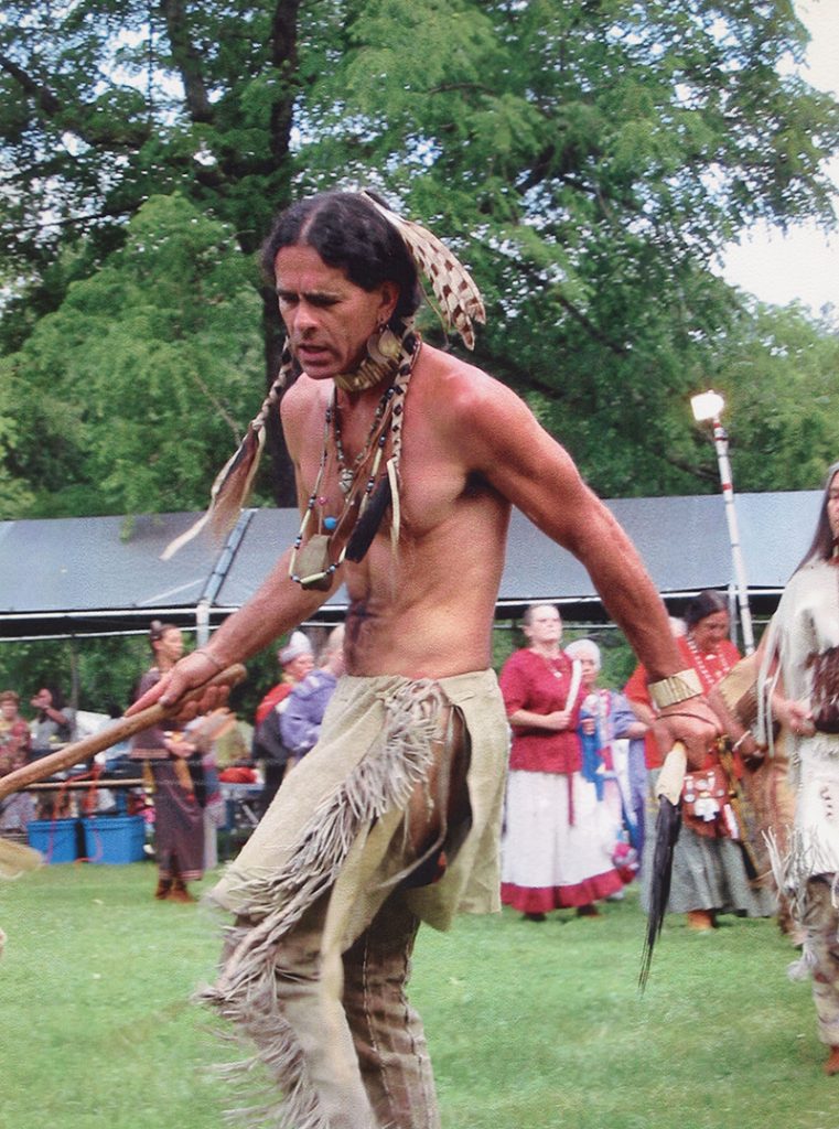
Occaneechi Saponi Powwow Hillsborough North Carolina June 13-14, 2003. Photographed by David Hunt. -

Occaneechi Saponi Powwow Hillsborough North Carolina June 13-14, 2003. Photographed by David Hunt. -
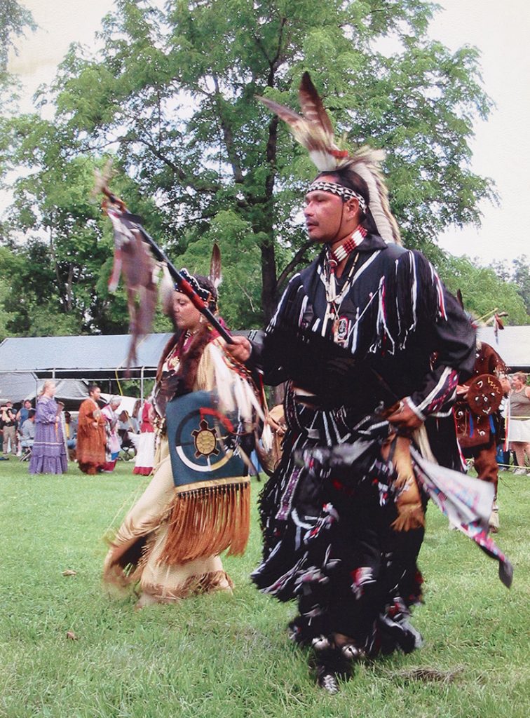
Occaneechi Saponi Powwow Hillsborough North Carolina June 13-14, 2003. Photographed by David Hunt. -

Occaneechi Saponi Powwow Hillsborough North Carolina June 13-14, 2003. Photographed by David Hunt. -

Occaneechi Saponi Powwow Hillsborough North Carolina June 13-14, 2003. Photographed by David Hunt.
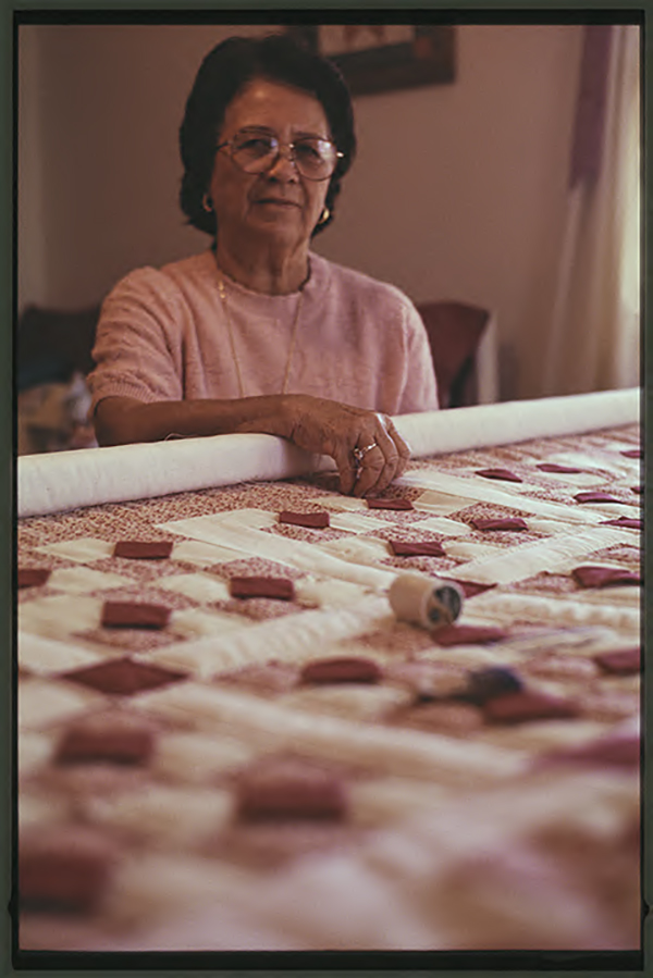
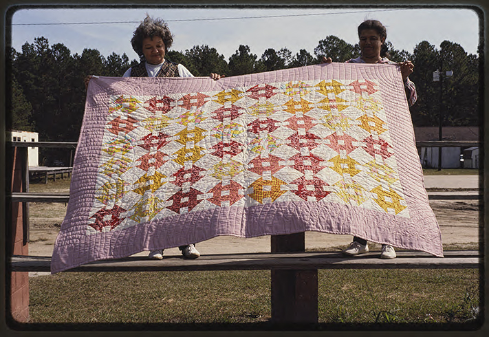
NAtive quilts and quilters
While working on her M.A. in Folklore from the University of North Carolina at Chapel Hill, Jill Hemming received a Documentation Project Grant from the Folklife Section of the North Carolina Arts Council to document and photograph quilts crafted by women of the Waccamaw Siouan Tribe of North Carolina. Hemming conducted the survey of Waccamaw Siouan quilts in Columbus and Bladen counties, N.C., 1994-1995. She made hundreds of images of Native quilts and quilters, taking care to document and attribute individual quilters in her notes and slide captions whenever possible. You can learn more about the Jill Hemming collection by visiting the finding aid created by Wilson Library.
-

Pieces of grandmother’s flower garden quilt by Shirley Freedman. Bolton, N.C., September 30, 1994 -
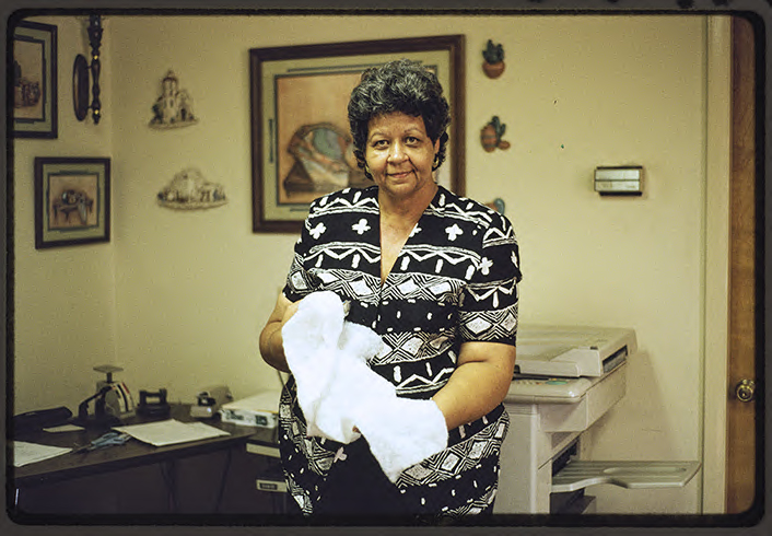
Quilter Shirley Freeman showing batting for a quilt, Bolton N.C., September 30, 1994 -
Quilter Juanita Jacobs, Bolton N.C., February 3, 1995 -
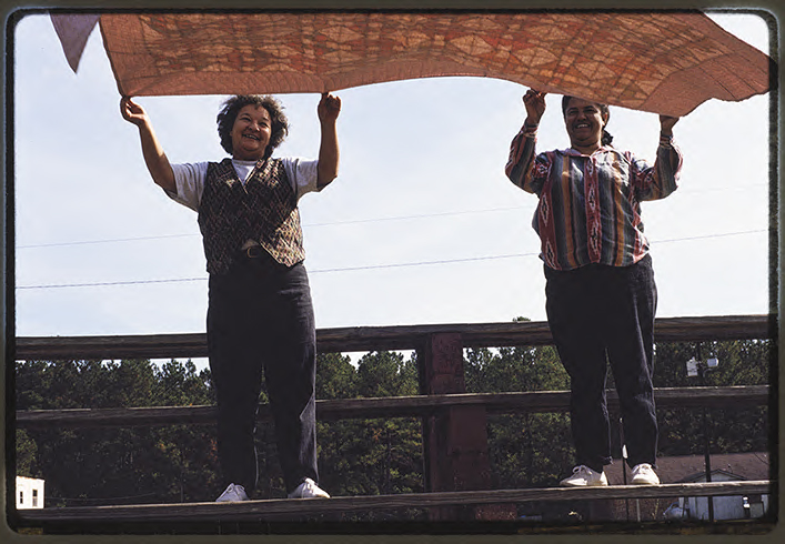
Quilters hold a quilt in the wind, Bolton N.C., 1994 -
Quilt by Mary Patrick, Bolton N.C., September 30, 1994
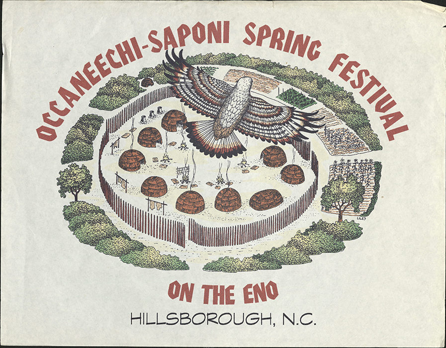
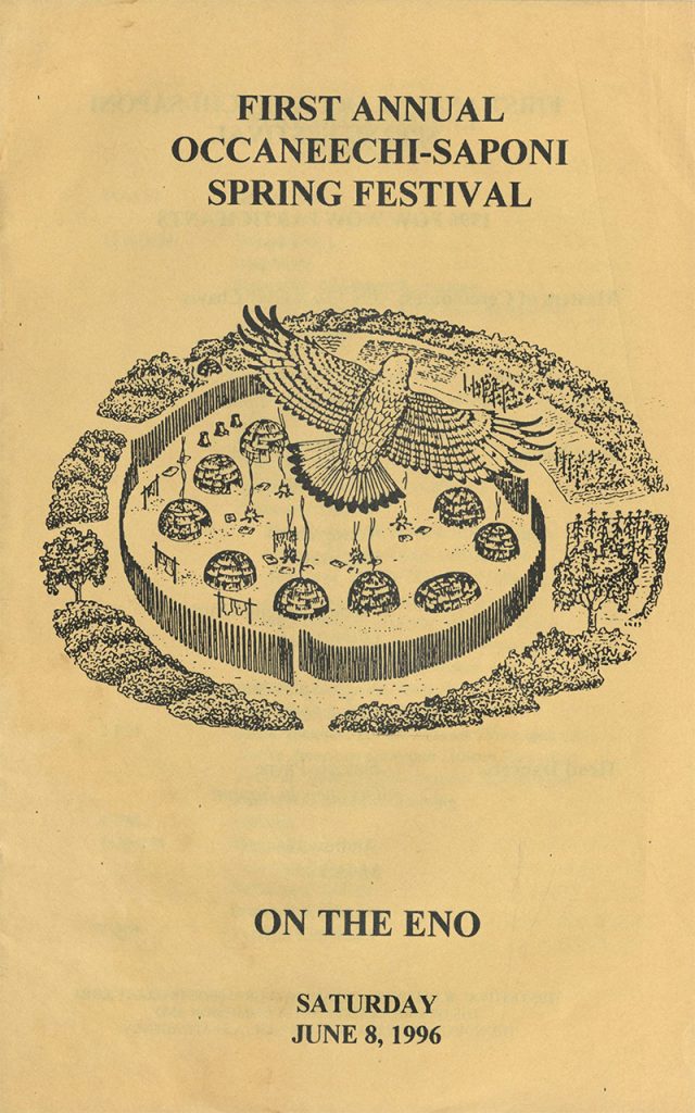
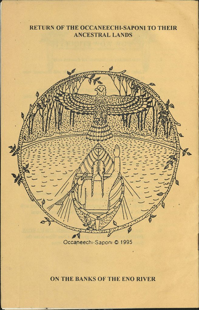
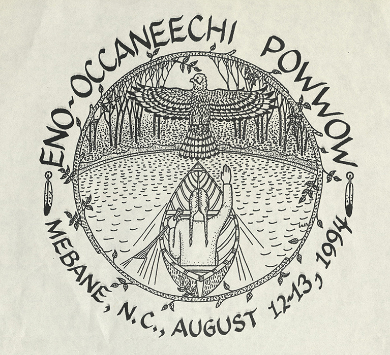
Occaneechi Band of the Saponi NAtion POWWOW Ephemera
These flyers and pamphlets were collected by John Blackfeather Jeffries and are part of his collection of materials in the Southern Historical Collection in Wilson Library. The events depicted in the flyers and pamphlets took place across North Carolina and Virginia.